Hamilton to Tauranga Corridor Spatial Study
What’s happening
Future Proof, in collaboration with SmartGrowth, is undertaking a high-level study that will identify the growth opportunities within the Hamilton to Tauranga Corridor.
The Study will give us a clear understanding of the growth area's unique needs and potential and will ensure that future economic growth and the necessary transport, water and utilities (power and telecommunication) infrastructure decisions are coordinated and aligned.
A key focus for the Study will be to identify how Future Proof can give effect to the government’s direction of lifting economic productivity and freight efficiency through enhancements in transport safety, connectivity and travel times. However as well as economic development, the Study will also focus on natural, environmental and cultural considerations.
By looking at the whole picture, we will be able to take a joined-up approach to forming a vision for development within the Hamilton to Tauranga area, resulting in better outcomes for the communities that exist within the area, as well as the people that travel through it.
The area we're looking at
This area spans over multiple territorial boundaries including Hamilton City Council, Matamata Piako District, Waipā District and South Waikato District.
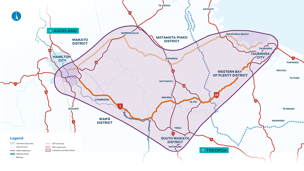 Click to enlarge
The key developments happening in the area
A critical project underway already in the area is the Cambridge to Piarere intersection and the Tauriko road improvements. These are both set to be completed by 2034 and once finished, will reduce the travel time between Hamilton and Tauranga by 9 – 14 minutes, depending on the time of day travelled.
We want to be able to maximise the expected benefits from the government’s investments in the Cambridge-to-Piarere and Tauriko segments of the roading network, and any future investment in the rail network.
We’re also aware that the future of the Hamilton to Tauranga Corridor area depends in part on proposed changes to the Resource Management Act, and current / future Fast Track proposals, but details of these are still to come.
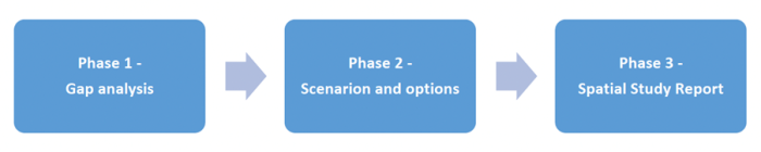
What is the study focusing on?
There are eight critical questions this study aims to answer for the Hamilton to Tauranga Corridor area.
1. Supporting future growth
What are the potential economic outcomes of transport investments including demand for development, types of jobs, and the necessary infrastructure required?
2. Economic benefits of rail
What are the potential economic benefits of integrating land use with rail along this corridor?
3. Role of Matamata-Piako and South Waikato areas
What is the role of the Matamata-Piako District and South Waikato District in the growth and development of the upper North Island?
4. Funding opportunities
How can we generate the necessary funds and resources to meet infrastructure demands? Specifically, are there any opportunities to use ‘value capture funding’ (funding from private landowners who benefit from public investment into the area) to fund the necessary growth infrastructure?
5. Staging and sequencing
How can we take a strategic approach to staging and sequencing infrastructure packages to achieve more efficient and effective outcomes?
6. Housing and papakainga
What additional infrastructure is likely to be required to support more housing and papakāinga along the Hamilton to Tauranga corridor and what are the challenges in achieving this?
7. Labour force accessibility
Where will workers live, and will the housing and transport costs be affordable?
8. Protecting the environment
How do we balance economic benefits with the need to protect and enhance our natural environment?
Gap analysis report
We haven’t started from scratch. There are a lot of planning documents already in place that guide certain development types across the Hamilton to Tauranga Corridor.
Things already confirmed include decisions made through the Hamilton to Tauranga Investment Programme, District Plan processes, community planning processes such as the Ahu Ake Waipā Community Spatial Plan and various economic and growth strategies such as the South Waikato Growth Plan.
We’ve completed a stocktake of all these documents which identifies the current knowledge and key information gaps across several major themes affecting growth, infrastructure provision, land use integration, and environmental constraints.
Sourced from an extensive literature review, it sets out to establish a clear understanding of what we currently know — and what remains uncertain — about the area's development potential.
Importantly, this gap analysis report provides insights into possible future states for the area, and has informed the scenarios / options report below.
Vision and outcome statements
Incorporating feedback from stakeholders, we have developed vision and outcome statements. These outcome statements define what success looks like for this Spatial Study and links to the Future Proof Strategy’s key transformational moves.
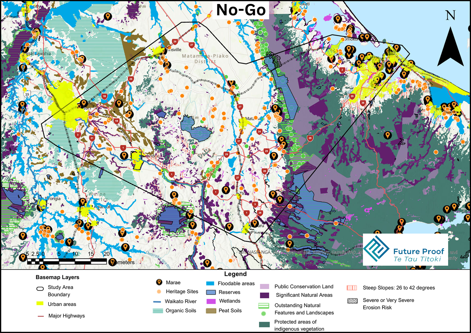
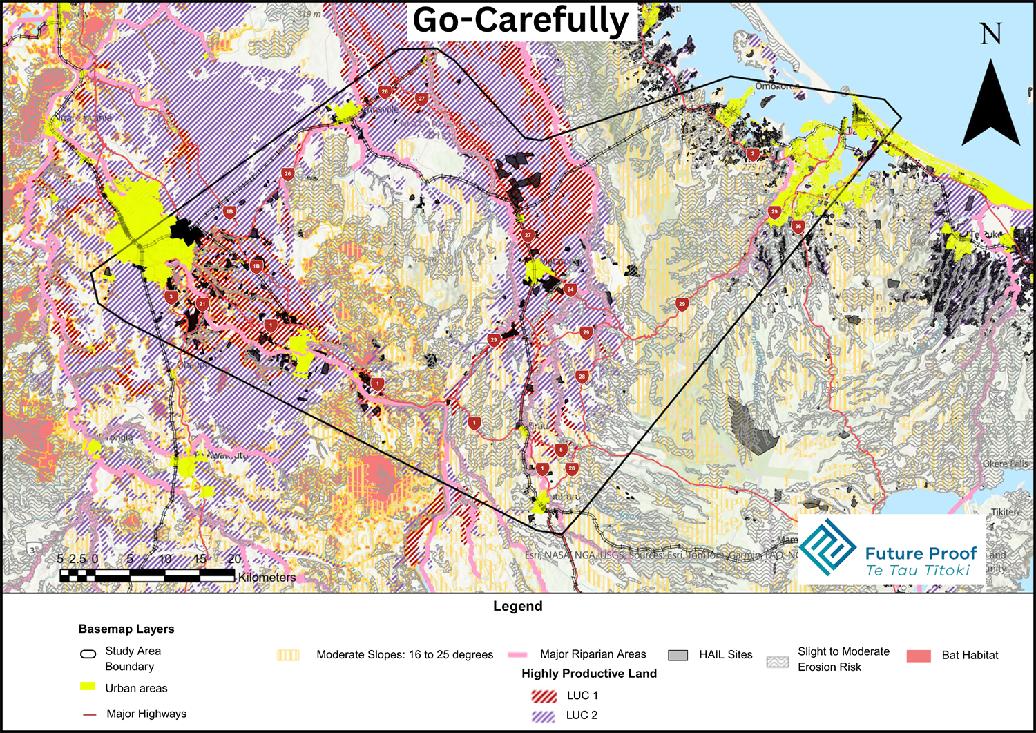
Scenarios
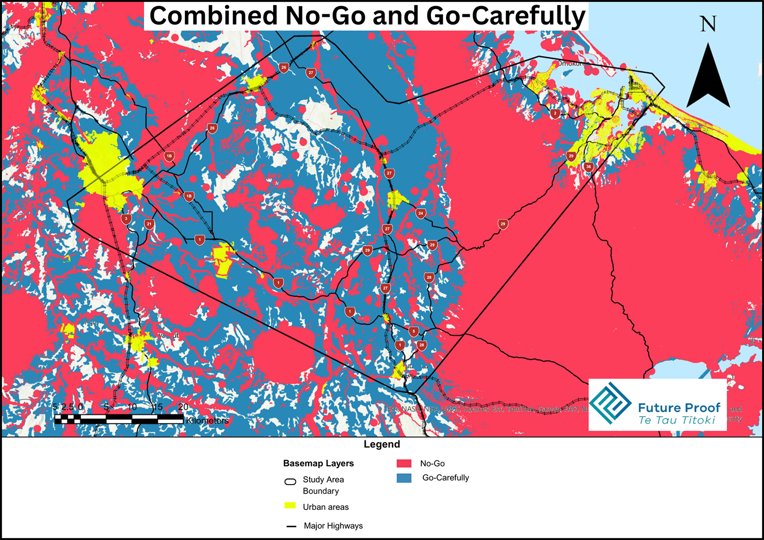
A scenarios report is now available that explores different ways in which growth along the Corridor might occur in the future, and the planning options to achieve the best outcomes.
The Scenarios summary document and full report references ‘Go / No’ and ‘Go Carefully’ areas.
Have your say
Feedback closed 5pm Monday 1 December. If you’d like to have a discussion, you can also request an online meeting with the project team. To arrange this, email futureproofcoordinator@waikatoregion.govt.nz.
What's next
The feedback received from this engagement will be used to inform the final report for the Hamilton to Tauranga Corridor Spatial Study, planned to be approved by the Future Proof Implementation Committee in the first half of 2026. The Study will then be used to inform the Future Proof Development Strategy which is due to be reviewed later in 2026.