North Waipā - South Hamilton Spatial Study
The opportunity
North Waipā – South Hamilton represents one of the Upper North Island’s most significant long-term economic development opportunities.
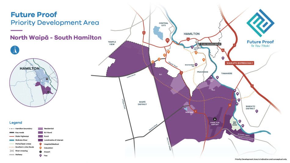
Anchored by Hamilton Airport and Mystery Creek and strategically located within the
Golden Triangle, the area combines nationally significant transport, freight, aviation and employment assets with substantial future growth capacity. It presents a rare opportunity to establish a high-value employment, logistics and innovation hub that strengthens productivity, supports investment and creates jobs while complementing existing growth across Hamilton, Ruakura, Cambridge and Te Awamutu.
Development interest is accelerating, fast-track proposals are emerging across the wider sub-region, and key infrastructure investments are moving toward delivery.
The question is not whether growth occurs, but whether it is coordinated to maximise
long-term economic value or allowed to proceed in a way that increases infrastructure
costs and constrains future opportunities.
Findings
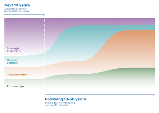
The study concludes by establishing a preferred growth framework and a staged implementation pathway. It sets direction without pre-empting formal decisions or requiring immediate funding commitments, while still being clear about what needs to be aligned now to unlock value.
Immediate priorities include:
- Confirm Airport shareholders' (Councils’) expectations for Waikato Regional Airport Limited (WRAL) and Titanium Park Limited.
- Initiate Economic Hub precinct master planning as an entry point to the Regional Spatial Plan.
- Convene a Strategic Economic Hub symposium.
- Prioritise Highly Productive Land (HPL) and peat mapping as key considerations in the Regional Spatial Plan process.
- Embed infrastructure triggers, sequencing and investment in statutory and investment planning instruments, including the Regional Spatial Plan, long-term plans and the Regional Land Transport Plan.
Beyond the first 10 years, implementation should shift from alignment and planning toward staged delivery and benefit realisation.
What's next:
The findings from this study will be of huge benefit as we plan for the future and will be used to influence the future Regional Spatial Plans that are being proposed under new planning legislation. Next steps include an economic hub symposium and precinct master planning process to continue the discussions and analysis initiated by this project.

![View a larger version of the map [JPG, 657 KB]](/assets/Future-Proof/PDA-Map-North-Waipa-and-South-Hamilton.jpg)